Fișier:Prince William's Parish Church (Ruins), Sheldon vicinity (Beaufort County, South Carolina).jpg

Prince_William's_Parish_Church_(Ruins),_Sheldon_vicinity_(Beaufort_County,_South_Carolina).jpg(588 × 411 pixeli, mărime fișier: 131 KB, tip MIME: image/jpeg)

Acest fișier se află la Wikimedia Commons. Consultați pagina sa descriptivă acolo.

This is an image of a place or building that is listed on the National Register of Historic Places in the United States of America. Its reference number is 70000562.

Descriere
English: Prince William's Parish Church (Ruins), Sheldon vicinity (Beaufort County, South Carolina) - (cropped)
This file comes from the Historic American Buildings Survey (HABS), Historic American Engineering Record (HAER) or Historic American Landscapes Survey (HALS). These are programs of the National Park Service established for the purpose of documenting historic places. Records consist of measured drawings, archival photographs, and written reports.

Acest format nu indică statutul de drept de autor sau sursa lucrării atașate. Un format normal și o sursă sunt de asemenea necesare. Vezi Commons:Licenţiere pentru mai multe informații.

Public domain This image or media file contains material based on a work of a National Park Service employee, created as part of that person's official duties. As a work of the U.S. federal government, such work is in the public domain in the United States. See the NPS website and NPS copyright policy for more information.
Poziția obiectului32° 37′ 06,7″ N, 80° 46′ 49,7″ V Kartographer map based on OpenStreetMap.Vizualizați poziția acestei și a altor imagini la: OpenStreetMapinfo
Dată
Sursă http://memory.loc.gov/cgi-bin/displayPhoto.pl?path=/pnp/habshaer/sc/sc0200/sc0277/photos&topImages=151946pr.jpg&topLinks=151946pv.jpg,151946pu.tif&title=HABS%20SC,7-SHELD,1-1&displayProfile=0
Autor NecunoscutUnknown author
Permisiune
(Reutilizarea acestui fișier)
This file comes from the Historic American Buildings Survey (HABS), Historic American Engineering Record (HAER) or Historic American Landscapes Survey (HALS). These are programs of the National Park Service established for the purpose of documenting historic places. Records consist of measured drawings, archival photographs, and written reports.


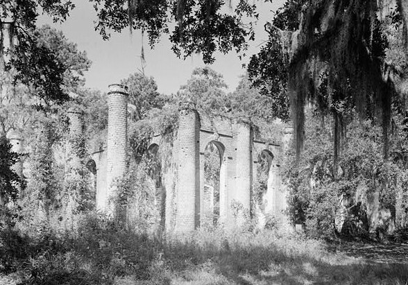
When reusing please credit: Library of Congress, Prints & Photographs Division, SC,7-SHELD,1-1
Acest format nu indică statutul de drept de autor sau sursa lucrării atașate. Un format normal și o sursă sunt de asemenea necesare. Vezi Commons:Licenţiere pentru mai multe informații.

Public domain This image or media file contains material based on a work of a National Park Service employee, created as part of that person's official duties. As a work of the U.S. federal government, such work is in the public domain in the United States. See the NPS website and NPS copyright policy for more information.

Captions

Add a one-line explanation of what this file represents

Items portrayed in this file

subiectul reprezentat

32°37'6.701"N, 80°46'49.699"W

image/jpeg

Istoricul fișierului

Apăsați pe Data și ora pentru a vedea versiunea trimisă atunci.

Data și oraMiniaturăDimensiuniUtilizatorComentariu
actuală4 iulie 2008 22:27Miniatură pentru versiunea din 4 iulie 2008 22:27588x411 (131 KB)KudzuVine{{Information |Description={{en|1=Prince William's Parish Church (Ruins), Sheldon vicinity (Beaufort County, South Carolina) - (cropped) {{PD-USGov-Interior-HABS}}}} |Source=http://memory.loc.gov/cgi-bin/displayPhoto.pl?path=/pnp/habshaer/sc/sc0200/sc0277

Următoarele pagini conțin această imagine:

Utilizarea globală a fișierului

Următoarele alte proiecte wiki folosesc acest fișier:

Informații