Fișier:Cheshire outline map with UK.png
Rezoluții mai mari nu sunt disponibile.
Cheshire_outline_map_with_UK.png (722 × 552 pixeli, mărime fișier: 412 KB, tip MIME: image/png)
| Acest fișier se află la Wikimedia Commons. Consultați pagina sa descriptivă acolo. |
Descriere fișier
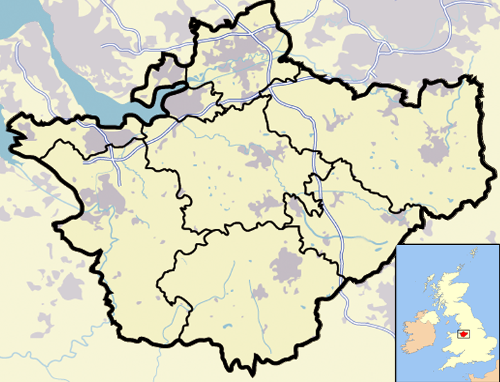
| Descriere | Map of en:Cheshire and surrounding area, with micromap of the British Isles for context. Urban areas are shown in grey, water bodies in light-blue, motorways in blue with white stripe and county and borough boundaries in black. |
| Dată | 29 martie 2007 (original upload date) |
| Sursă | Transferred from en.wikipedia to Commons. |
| Autor | Jhamez84 at engleză Wikipedia |
| Alte versiuni |
.png) (for boundaries expected to come into effect for 2009). (for boundaries expected to come into effect for 2009). |
Licențiere
| Această operă a fost eliberată domeniului public de către autorul său, Jhamez84 at engleză Wikipedia. Aceasta se aplică în întreaga lume. În anumite țări există posibilitatea ca acest lucru să nu fie legal posibil; în acest caz: Jhamez84 permite oricui să utilizeze această operă în orice scop, fără nicio condiție, atâta timp cât asemenea condiții nu sunt cerute de lege. |
Jurnalul original al încărcărilor
Pagina originală de descriere a fost aici. Toate numele de utilizator de mai jos sunt pentru en.wikipedia.
- 2007-04-11 23:50 Jhamez84 722×552×8 (421996 bytes) correcting positioning of some urban areas (they were too east-northeasterly)
- 2007-04-11 17:14 Jhamez84 722×552×8 (420187 bytes) fixing issues in and around the [[M6 motorway]] (moving it to the west per discussion)
- 2007-04-11 00:38 Jhamez84 722×552×8 (438177 bytes) Much more detailed (and thus hopefully more accurate) version of the [[Cheshire]] map.
- 2007-03-29 23:48 Jhamez84 800×558×8 (446798 bytes) Map of [[Cheshire]] and surrounding area, with micromap of the British Isles for context. Urban areas are shown in grey, water bodies in light-blue, motorways in blue with white stripe and county and borough boundaries in black.
Istoricul fișierului
Apăsați pe Data și ora pentru a vedea versiunea trimisă atunci.
| Data și ora | Miniatură | Dimensiuni | Utilizator | Comentariu | |
|---|---|---|---|---|---|
| actuală | 23 iunie 2008 16:02 | | 722x552 (412 KB) | Jza84 | removed erroneous urban area |
| 29 iunie 2007 23:55 |  | 722x552 (412 KB) | Pit-yacker | {{Information |Description=Map of en:Cheshire and surrounding area, with micromap of the British Isles for context. Urban areas are shown in grey, water bodies in light-blue, motorways in blue with white stripe and county and borough boundaries in bl |
Utilizarea fișierului
Următoarele pagini conțin această imagine:
Utilizarea globală a fișierului
Următoarele alte proiecte wiki folosesc acest fișier:
- Utilizare la ar.wikipedia.org
- Utilizare la ceb.wikipedia.org
- Utilizare la en.wikipedia.org
- Utilizare la eo.wikipedia.org
- Utilizare la ga.wikipedia.org
- Utilizare la ml.wikipedia.org
- Utilizare la pt.wikipedia.org
- Utilizare la sv.wikipedia.org
- Utilizare la tt.wikipedia.org
- Utilizare la uk.wikipedia.org
- Utilizare la www.wikidata.org