Fișier:Earth Western Hemisphere.jpg
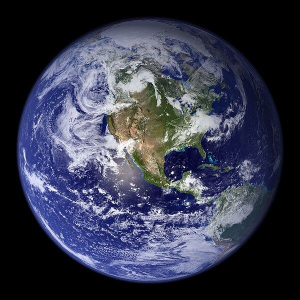
Mărimea acestei previzualizări: 600 × 600 pixeli. Alte rezoluții: 240 × 240 pixeli | 480 × 480 pixeli | 768 × 768 pixeli | 1.024 × 1.024 pixeli | 2.048 × 2.048 pixeli.
Mărește rezoluția imaginii (2.048 × 2.048 pixeli, mărime fișier: 579 KB, tip MIME: image/jpeg)
Istoricul fișierului
Apăsați pe Data și ora pentru a vedea versiunea trimisă atunci.
| Data și ora | Miniatură | Dimensiuni | Utilizator | Comentariu | |
|---|---|---|---|---|---|
| actuală | 25 august 2005 06:09 | 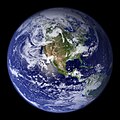 | 2.048x2.048 (579 KB) | Tom | {{PD-USGov-NASA}} http://earthobservatory.nasa.gov/Newsroom/BlueMarble/Images/globe_west_2048.jpg Much of the information contained in this image came from a single remote-sensing device-NASA’s Moderate Resolution Imaging Spectroradiometer, or MODIS. |
Utilizarea fișierului
Mai mult de 100 pagini folosesc acest fișier. Următoarea listă arată primele 100 legături către acest fișier. Este disponibilă o listă completă.
- Africa
- America de Nord
- America de Sud
- Antarctica
- Antarctida
- Asia
- Biom
- Continent
- Ecologie
- Ecosistem
- Geografie
- Geologie
- Lume
- Mediu
- Natură
- Ocean
- Oceanul Antarctic
- Oceanul Arctic
- Oceanul Atlantic
- Oceanul Indian
- Oceanul Pacific
- Pământ
- Sistemul solar
- Straturile Pământului
- Tectonica plăcilor
- Ziua Planetei Pământ
- Utilizator:Adrian Cremene
- Utilizator:Adyadriano
- Utilizator:Albacore60
- Utilizator:Alinoboyon
- Utilizator:Amara~rowiki
- Utilizator:AntonK
- Utilizator:Aquillas
- Utilizator:Astristul
- Utilizator:Baditastefan
- Utilizator:Balan Adrian - Ioan
- Utilizator:Basti2400
- Utilizator:Bekuletz
- Utilizator:Ben 150
- Utilizator:Compactforever
- Utilizator:Cosmo Kramer
- Utilizator:Cretzu88 tl
- Utilizator:Cscescu
- Utilizator:Curcan ionel
- Utilizator:DPP
- Utilizator:Danicutu2002
- Utilizator:Der metzgermeister~rowiki
- Utilizator:EMINESCU
- Utilizator:Ericandrei
- Utilizator:Gabitzu 6b
- Utilizator:Gabitzu~rowiki
- Utilizator:Godfroid
- Utilizator:Grasshopper~rowiki
- Utilizator:Ina Oltean
- Utilizator:Intelitem
- Utilizator:Ionel c
- Utilizator:IonutBizau
- Utilizator:Izvora
- Utilizator:JeffHardy
- Utilizator:Johnny Angel
- Utilizator:Krokodilu
- Utilizator:Leftbogdan
- Utilizator:Luciengav
- Utilizator:Luigi Salvatore Vadacchino
- Utilizator:LyKy
- Utilizator:Ma2000
- Utilizator:Mal`Ganis
- Utilizator:MarcMazilu
- Utilizator:Marcos56
- Utilizator:Mario1987
- Utilizator:Marius.deaconu/Pagina de utilizator
- Utilizator:Marius.deaconu/Prezentare
- Utilizator:Mariusika
- Utilizator:Mihai alex03
- Utilizator:Mishelmp
- Utilizator:Mr. Kennedy~rowiki
- Utilizator:Niki1971
- Utilizator:Olahus2
- Utilizator:Parvus7/Interese
- Utilizator:Parvus7/stil
- Utilizator:Petrvs
- Utilizator:Planck
- Utilizator:Razool
- Utilizator:Red Zenith
- Utilizator:Roces
- Utilizator:Rocket speed
- Utilizator:Sahmeditor
- Utilizator:Severina
- Utilizator:Sorinucu2007
- Utilizator:Spyball
- Utilizator:Svlad
- Utilizator:Tiberius~rowiki
- Utilizator:Tigrul-alb
- Utilizator:Tudor pepi
- Utilizator:Vinterriket
- Utilizator:Vl1175
- Utilizator:VladuB(Vorpal)
- Utilizator:Wicked01
- Utilizator:Zmbzgr
- Wikipedia:Căsuțe de utilizator/Educație
Vedeți mai multe legături către acest fișier.
Utilizarea globală a fișierului
Următoarele alte proiecte wiki folosesc acest fișier:
- Utilizare la af.wikipedia.org
- Utilizare la ang.wikipedia.org
- Utilizare la ar.wikipedia.org
- العالم
- الأرض
- آسيا
- قارة
- المحيط الهندي
- المحيط الهادئ
- القارة القطبية الجنوبية
- أمريكا الشمالية
- أمريكا الجنوبية
- علم البيئة
- نظام بيئي
- المحيط المتجمد الشمالي
- علوم الأرض
- المحيط الجنوبي
- الصفائح التكتونية
- طبيعة
- محيط (جغرافيا)
- تاريخ الأرض
- حيوم
- أستراليا (قارة)
- تغير أسماء دول آسيا خلال القرن العشرين
- برية
- إفريقيا
- المحيط الأطلسي
- بوابة:المجموعة الشمسية
- تاريخ الأرض الجيولوجي
- العالم من دوننا (كتاب)
- بنية الأرض
- قالب:الأرض الطبيعية
- مستقبل الأرض
- اختلال بيئي
- أرض صلبة
- مركز مراقبة علوم وموارد الأرض
- بوابة:المجموعة الشمسية/قوالب
- تاريخ آسيا الوسطى
- بيئة طبيعية
- مستخدم:Nehaoua/مهامي
- دائرة قطبية
- تضاريس قارة إفريقيا
- الفريق المعني برصد الأرض
- بوابة:محيطات
- بوابة:محيطات/قوالب
- Utilizare la arz.wikipedia.org
- Utilizare la ast.wikipedia.org
- Utilizare la bg.wikipedia.org
Vizualizați utilizările globale ale acestui fișier.


