Fișier:Map of USA HI full.png
Rezoluții mai mari nu sunt disponibile.
Map_of_USA_HI_full.png (286 × 186 pixeli, mărime fișier: 21 KB, tip MIME: image/png)
| Acest fișier se află la Wikimedia Commons. Consultați pagina sa descriptivă acolo. |
Descriere fișier

|
O versiune vectorială a acestei imagini (SVG) este disponibilă.
Aceasta ar trebui folosită în locul vechii imagini pentru o afișare mai bună la rezoluții mari. File:Map of USA HI full.png → File:Map of USA HI full.svg
Pentru mai multe informații despre imaginile vectoriale, consultați pagina Commons transition to SVG. Vedeți, de asemenea, și informațiile despre modul în care software-ul MediaWiki acceptă imagini în format SVG. |
 |
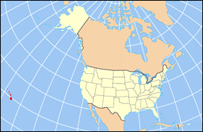
| Descriere | Map of USA with Hawaii highlighted and shown in true position |
| Sursă | http://www.nationalatlas.gov/printable/reference.html |
| Autor |
Licențiere
This map was obtained from an edition of the National Atlas of the United States. Like almost all works of the U.S. federal government, works from the National Atlas are in the public domain in the United States.
Online access: NationalAtlas.gov | 1970 print edition: Library of Congress, Perry-Castañeda Library
|
Istoricul fișierului
Apăsați pe Data și ora pentru a vedea versiunea trimisă atunci.
| Data și ora | Miniatură | Dimensiuni | Utilizator | Comentariu | |
|---|---|---|---|---|---|
| actuală | 2 aprilie 2007 19:30 | | 286x186 (21 KB) | MattWright | fix to more standard map colors |
| 1 aprilie 2007 22:09 |  | 286x186 (19 KB) | MattWright | {{Information |Description=Map of USA with Hawaii highlighted and shown in true position |Source=http://www.nationalatlas.gov/printable/reference.html |Date= |Author= |Permission= |other_versions= }} Category:Maps of the United States [[Category:Maps |
Utilizarea fișierului
Următoarele pagini conțin această imagine:
Utilizarea globală a fișierului
Următoarele alte proiecte wiki folosesc acest fișier:
- Utilizare la bcl.wikipedia.org
- Utilizare la bo.wikipedia.org
- Utilizare la da.wikipedia.org
- Utilizare la en.wikipedia.org
- Utilizare la es.wikipedia.org
- Utilizare la fa.wikipedia.org
- Utilizare la hu.wikipedia.org
- Utilizare la id.wikipedia.org
- Utilizare la ja.wikipedia.org
- Utilizare la ko.wikipedia.org
- Utilizare la mrj.wikipedia.org
- Utilizare la mr.wikipedia.org
- Utilizare la pl.wikipedia.org
- Utilizare la pl.wikinews.org
- Utilizare la pl.wiktionary.org
- Utilizare la sv.wikipedia.org
- Utilizare la uk.wikipedia.org
- Utilizare la vi.wikipedia.org