Fișier:Ogasawara islands.png
Mărimea acestei previzualizări: 760 × 600 pixeli. Alte rezoluții: 304 × 240 pixeli | 608 × 480 pixeli | 1.011 × 798 pixeli.
Mărește rezoluția imaginii (1.011 × 798 pixeli, mărime fișier: 296 KB, tip MIME: image/png)
| Acest fișier se află la Wikimedia Commons. Consultați pagina sa descriptivă acolo. |
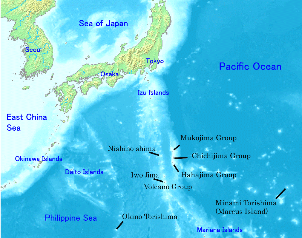
Map of Ogasawara Islands. Created by Map of ogasawara islands.png
This image is in the public domain because it came from the site https://www.demis.nl/products/web-map-server/examples/ and was released by the copyright holder. Permission is granted to copy, distribute and/or modify this map since it is based on free of copyright images from: www.demis.nl. See also approval email on de.wp and its clarification.
|
| This work has been released into the public domain by its copyright holder, www.demis.nl. This applies worldwide. În anumite țări există posibilitatea ca acest lucru să nu fie legal posibil; în acest caz: www.demis.nl permite oricui să utilizeze această operă în orice scop, fără nicio condiție, atâta timp cât asemenea condiții nu sunt cerute de lege.
|
Istoricul fișierului
Apăsați pe Data și ora pentru a vedea versiunea trimisă atunci.
| Data și ora | Miniatură | Dimensiuni | Utilizator | Comentariu | |
|---|---|---|---|---|---|
| actuală | 1 ianuarie 2008 01:01 | | 1.011x798 (296 KB) | Sagredo | Created by [http://commons.wikimedia.org/wiki/Image:Map_of_ogasawara_islands.png Map of ogasawara islands.png] {{Information |Description=Map of Ogasawara Islands. |Source= |Date= |Author= |Permission={{demis-pd}} }} |
| 30 aprilie 2006 08:29 |  | 1.011x798 (260 KB) | Tdk~commonswiki | Map of Ogasawara Islands. Created by [Image:Map of ogasawara islands.png] {{demis-pd}} |
Utilizarea fișierului
Următoarele pagini conțin această imagine:
Utilizarea globală a fișierului
Următoarele alte proiecte wiki folosesc acest fișier:
- Utilizare la ar.wikipedia.org
- Utilizare la ast.wikipedia.org
- Utilizare la az.wikipedia.org
- Utilizare la ban.wikipedia.org
- Utilizare la ca.wikipedia.org
- Utilizare la cs.wikipedia.org
- Utilizare la cy.wikipedia.org
- Utilizare la en.wikipedia.org
- Geography of Japan
- Tokyo
- List of islands of Japan
- Bonin Islands
- Ogasawara, Tokyo
- Japanese archipelago
- Nanpō Islands
- Portal:Japan
- Bonin white-eye
- Wikipedia:Graphics Lab/Images to improve/Archive/Jan 2008
- Ogasawara Subprefecture
- Wandering Island
- List of governors of the Nanpō Islands
- Geography of the Bonin Islands
- Utilizare la eo.wikipedia.org
- Utilizare la es.wikipedia.org
- Utilizare la eu.wikipedia.org
- Utilizare la fa.wikipedia.org
- Utilizare la fi.wikipedia.org
- Utilizare la fr.wikipedia.org
- Utilizare la gl.wikipedia.org
- Utilizare la he.wikipedia.org
- Utilizare la hr.wikipedia.org
- Utilizare la hy.wikipedia.org
- Utilizare la id.wikipedia.org
- Utilizare la ilo.wikipedia.org
Vizualizați utilizările globale ale acestui fișier.