Mărește rezoluția imaginii(Fișier SVG, cu dimensiunea nominală de 2.220 × 1.554 pixeli, mărime fișier: 573 KB)

Acest fișier se află la Wikimedia Commons. Consultați pagina sa descriptivă acolo.

Descriere fișier

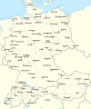
Descriere Test version of a vectorized File:Rzeczpospolita 1920.png; more changes will follow, only checking if wiki displays it right
Dată
Sursă

Operă proprie; based on an earlier raster map made in 2005, as well as similar maps made by myself in 2004 (see below).
In preparation of this map I used many other maps as sources and backup. Among them were:

  • a German roadmap of Poland printed in 1938 (colours and the shape of East Prussian border)
  • and perhaps a dozen others.
Autor Halibutt
Alte versiuni
SVG dezvoltare
InfoField
 
The source code of this SVG is invalid due to 2 errors.
 
Această imagine vectorială a fost creată cu Adobe Illustrator,
 
and with Inkscape.
 
 This map uses embedded text that can be easily translated using a text editor.


Copyright notice: Image made by Halibutt and uploaded to Wikipedia by the author. Images can be made available for use under other copyleft licenses on a case by case basis via direct contact with the author. Under moral rights the user requires that this work be properly attributed to its creator. For photographs, this is traditionally done in the image caption. Where a copyright notice is present, using the copyright notice in the caption will be sufficient. Note that the GFDL requires that any copyright notices be included with the work even when making unmodified use of it.

Since the legal status of the above comment has been questioned, I hereby grant anyone the right to treat it as either a standard copyright notice, invariant section, legal statement, legal advice, friendly suggestion or a mere comment, depending on his or hers own choice.
Halibutt
GNU head Se permite copierea, distribuirea și/sau modificarea acestui document conform termenilor Documentației de licență liberă GNU, versiunea 1.2 sau orice altă versiune ulterioară publicată de Free Software Foundation, fără părți neschimbabile, texte de pe copertele principale și finale. O copie a acestei licențe este inclusă în secțiunea numită Documentația de licență liberă GNU.
w:ro:Creative Commons
atribuind partajând în condiții identice
Acest fișier a fost eliberat sub licența Creative Commons Atribuire și distribuire în condiții identice 3.0 Neadaptată.
Sunteți liber:
  • să partajați cu alții – aveți dreptul de a copia, distribui și transmite opera
  • să adaptați – aveți dreptul de a adapta opera
În următoarele condiții:
  • atribuind – Trebuie să atribuiți opera corespunzător, introducând o legătură către licență și indicând dacă ați făcut schimbări. Puteți face asta prin orice metodă rezonabilă, dar nu într-un fel care ar sugera faptul că persoana ce a licențiat conținutul v-ar susține sau ar aproba folosirea de către dumneavoastră a operei sale.
  • partajând în condiții identice – Dacă modificați, transformați sau creați pe baza acestei opere, trebuie să distribuiți opera rezultată doar sub aceeași licență sau sub o licență similară acesteia.
Această licență a fost atașată fișierului ca parte a actualizării licențierilor GFDL.

The following is a list of maps created by Halibutt and uploaded to commons, as well as their present and projected derivatives.

Parent Image Image Description
  Maps by Halibutt
Image:Rzeczpospolita.png Image:Rzeczpospolita.png The Republic in 17th and 18th century
Image:Rzeczpospolita 1600.png The Republic after the Treaty of Dywilino
Image:Rzeczpospolita voivodships.png Voivodships of The Republic
Image:Rzeczpospolita_Potop.png The Republic during The Deluge and Chmielnicki Uprising, with major battles of the era marked
Magnates and their lands and domains
1st2nd3rd Partitions of Poland
War of the constitution
Image:Rzeczpospolita.xcf SOURCE FILE - GIMP format
Image:Poland 1939.png Image:Poland 1939.png Poland in 1939
Image:Dywizje wrzesien 1.png Order of Battle on September 1st, during the Polish Defence War of 1939
Image:Poland 1939.xcf SOURCE FILE - GIMP format
Image:Polska kontur bialy.png Image:Polska kontur bialy.png Contour map of Poland AD 1999, for use with various locator maps
Image:Rzeczpospolita 1923.png Image:Rzeczpospolita 1923.png Map of Poland 1918-1939, currently under development
Image:PBW March 1919.png Polish-Bolshevik War - fronts in March of 1919
Image:PBW December 1919.png Polish-Bolshevik War - fronts in December of 1919
Image:PBW June 1920.png Polish-Bolshevik War - fronts in July of 1920
Image:PBW August 1920.png Polish-Bolshevik War - fronts in August of 1920
Polish Defence War of 1939
Polish areas annexed by Germany, Lithuania, Slovakia and the Soviet Union
German concentration camps in Poland
Curzon line
Major battles of the Polish-Bolshevik War
namesno names Polish/Czechoslovak/Lithuanian/German/Ukrainian claims in 1920's
Image:Rzeczpospolita Central Lithuania.png Central Lithuania
Image:Rzeczpospolita Lithuania claims.png Central Lithuania as compared with other Lithuanian claims
Image:Rzeczpospolita 1789-1920.png Post-1922 borders compared with the territory of Poland before the partitions
Warsaw Uprising and the Operation Tempest
Poland partitioned between the Soviets and the Germans
Image:Rzeczpospolita 1939 Polish divisions.png Polish divisions on September 1, 1939
Home Army inspectorates
Image:Rzeczpospolita 1922.xcf SOURCE FILE - GIMP format
Image:Rzeczpospolita 1937.svg Vector version!!!! layered version available on request

Captions

Add a one-line explanation of what this file represents

Items portrayed in this file

subiectul reprezentat

11 martie 2008

Istoricul fișierului

Apăsați pe Data și ora pentru a vedea versiunea trimisă atunci.

(Ultimele | Primele) Vezi (10 mai noi | ) (10 | 20 | 50 | 100 | 250 | 500)
Data și oraMiniaturăDimensiuniUtilizatorComentariu
actuală1 ianuarie 2017 18:24Miniatură pentru versiunea din 1 ianuarie 2017 18:242.220x1.554 (573 KB)Sascha GPDMalmö (duplicate) -> Göteborg
30 iulie 2013 17:34Miniatură pentru versiunea din 30 iulie 2013 17:342.220x1.554 (573 KB)HalibuttAdded some rivers in Russia, corrected others (RO, HU, PL)
30 iulie 2013 06:28Miniatură pentru versiunea din 30 iulie 2013 06:282.220x1.563 (458 KB)HalibuttSweden corrected (town names added)
30 iulie 2013 06:16Miniatură pentru versiunea din 30 iulie 2013 06:162.214x1.567 (492 KB)Halibuttcrunched version (deleted background layers)
30 iulie 2013 06:13Miniatură pentru versiunea din 30 iulie 2013 06:132.214x1.567 (3,68 MB)Halibuttlet's see if the expanded version works
16 iulie 2010 21:11Miniatură pentru versiunea din 16 iulie 2010 21:112.014x1.567 (534 KB)HierakaresCorrected position of name Oppeln which was overlapping with point.
14 martie 2008 11:54Miniatură pentru versiunea din 14 martie 2008 11:542.014x1.567 (534 KB)HalibuttNames of larger towns enlarged
14 martie 2008 11:45Miniatură pentru versiunea din 14 martie 2008 11:452.014x1.567 (533 KB)Halibuttversion corrected by Madman
14 martie 2008 03:30Miniatură pentru versiunea din 14 martie 2008 03:302.000x1.534 (512 KB)Halibutt{{Information |Description= |Source=self-made |Date= |Author= Halibutt |Permission= |other_versions= }}
14 martie 2008 02:54Miniatură pentru versiunea din 14 martie 2008 02:542.000x1.534 (548 KB)Halibutt{{Information |Description= |Source=self-made |Date= |Author= Halibutt |Permission= |other_versions= }}
(Ultimele | Primele) Vezi (10 mai noi | ) (10 | 20 | 50 | 100 | 250 | 500)

Următoarele pagini conțin această imagine:

Utilizarea globală a fișierului

Următoarele alte proiecte wiki folosesc acest fișier:

Vizualizați utilizările globale ale acestui fișier.

Informații