Fișier:Solomon Islands 1989.jpg
Mărimea acestei previzualizări: 750 × 600 pixeli. Alte rezoluții: 300 × 240 pixeli | 600 × 480 pixeli | 961 × 768 pixeli | 1.203 × 962 pixeli.
Mărește rezoluția imaginii (1.203 × 962 pixeli, mărime fișier: 131 KB, tip MIME: image/jpeg)
| Acest fișier se află la Wikimedia Commons. Consultați pagina sa descriptivă acolo. |
Descriere fișier
| Descriere |
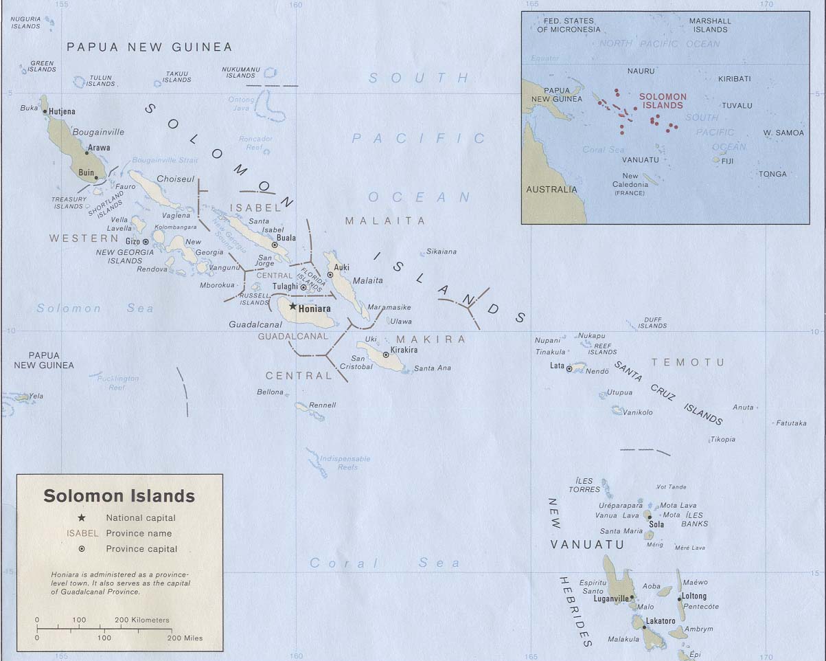
English: Map of the Solomon Islands as of 1989. Province names are included, except for two new provinces as of 1995: the Rennell and Bellona Province (formerly part of Central Province) and the Choiseul Province (formerly part of Western Province). |
| Dată | |
| Sursă | Solomon Islands (Political) 1989 from Perry-Castañeda Library Map Collection: Solomon Islands Maps. Cropped to remove white space from edges of map. |
| Autor | U.S. Central Intelligence Agency |
| Permisiune (Reutilizarea acestui fișier) |
Public domain |
Licențiere
| This image is a work of a Central Intelligence Agency employee, taken or made as part of that person's official duties. As a Work of the United States Government, this image or media is in the public domain in the United States.
|

|
Istoricul fișierului
Apăsați pe Data și ora pentru a vedea versiunea trimisă atunci.
| Data și ora | Miniatură | Dimensiuni | Utilizator | Comentariu | |
|---|---|---|---|---|---|
| actuală | 25 august 2009 22:27 | | 1.203x962 (131 KB) | Zyxw | == {{int:filedesc}} == {{Information | description = {{en|Map of the Solomon Islands as of 1989. Province names are included, except for two new provinces as of 1995: the [[:en:Rennell and B |
Utilizarea fișierului
Următoarele pagini conțin această imagine:
Utilizarea globală a fișierului
Următoarele alte proiecte wiki folosesc acest fișier:
- Utilizare la af.wikipedia.org
- Utilizare la ar.wikipedia.org
- Utilizare la az.wiktionary.org
- Utilizare la bg.wikipedia.org
- Utilizare la br.wikipedia.org
- Utilizare la ca.wikipedia.org
- Utilizare la cs.wikipedia.org
- Utilizare la en.wikipedia.org
- Utilizare la es.wikipedia.org
- Utilizare la eu.wikipedia.org
- Utilizare la fr.wikipedia.org
- Utilizare la gl.wikipedia.org
- Utilizare la hr.wikipedia.org
- Utilizare la hu.wikipedia.org
- Utilizare la hy.wikipedia.org
- Utilizare la id.wikipedia.org
- Utilizare la pa.wikipedia.org
- Utilizare la pl.wikipedia.org
- Utilizare la pl.wiktionary.org
- Utilizare la pt.wikipedia.org
- Utilizare la ru.wikipedia.org
- Utilizare la sco.wikipedia.org
- Utilizare la simple.wikipedia.org
- Utilizare la su.wikipedia.org
- Utilizare la tpi.wikipedia.org
- Utilizare la tr.wikipedia.org
- Utilizare la uk.wikipedia.org
- Utilizare la wuu.wikipedia.org
Vizualizați utilizările globale ale acestui fișier.