Fișier:Cyprus BufferZoneInBlue.png
Rezoluții mai mari nu sunt disponibile.
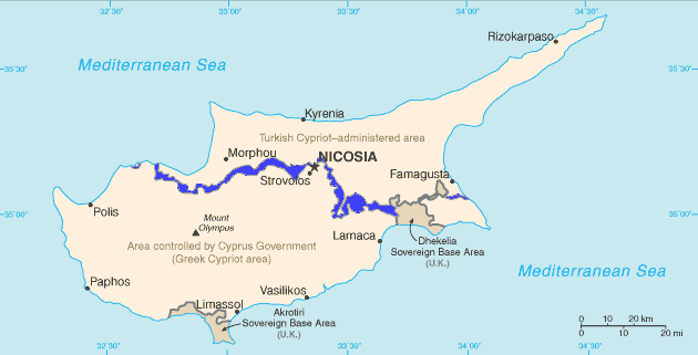
Cyprus_BufferZoneInBlue.png (630 × 321 pixeli, mărime fișier: 21 KB, tip MIME: image/png)
| Acest fișier se află la Wikimedia Commons. Consultați pagina sa descriptivă acolo. |
English: Map of Cyprus with the UN Buffer Zone in blue. The map is adapted from the CIA World Factbook map.
This image is in the public domain because it contains materials that originally came from the United States Central Intelligence Agency's World Factbook.
|
 |
Istoricul fișierului
Apăsați pe Data și ora pentru a vedea versiunea trimisă atunci.
| Data și ora | Miniatură | Dimensiuni | Utilizator | Comentariu | |
|---|---|---|---|---|---|
| actuală | 11 februarie 2007 14:13 | | 630x321 (21 KB) | Hoshie | {{english}} Map of Cyprus with the UN Buffer Zone in blue, the traditional color on maps for British possessions. The map is adapted from the [http://www.cia.gov/cia/publications/factbook/maps/cy-map.gif CIA World Factbook] map. |
Utilizarea fișierului
Următoarele pagini conțin această imagine:
Utilizarea globală a fișierului
Următoarele alte proiecte wiki folosesc acest fișier:
- Utilizare la ar.wikipedia.org
- Utilizare la ca.wikipedia.org
- Resolució 472 del Consell de Seguretat de les Nacions Unides
- Resolució 482 del Consell de Seguretat de les Nacions Unides
- Resolució 486 del Consell de Seguretat de les Nacions Unides
- Resolució 510 del Consell de Seguretat de les Nacions Unides
- Resolució 526 del Consell de Seguretat de les Nacions Unides
- Resolució 544 del Consell de Seguretat de les Nacions Unides
- Resolució 553 del Consell de Seguretat de les Nacions Unides
- Resolució 634 del Consell de Seguretat de les Nacions Unides
- Resolució 680 del Consell de Seguretat de les Nacions Unides
- Resolució 697 del Consell de Seguretat de les Nacions Unides
- Resolució 1000 del Consell de Seguretat de les Nacions Unides
- Resolució 1283 del Consell de Seguretat de les Nacions Unides
- Resolució 1384 del Consell de Seguretat de les Nacions Unides
- Resolució 1687 del Consell de Seguretat de les Nacions Unides
- Resolució 1847 del Consell de Seguretat de les Nacions Unides
- Resolució 1953 del Consell de Seguretat de les Nacions Unides
- Resolució 1986 del Consell de Seguretat de les Nacions Unides
- Zona coixí
- Utilizare la ckb.wikipedia.org
- بڕیارنامەی ٤٧٢ی ئەنجومەنی ئاسایش
- بڕیارنامەی ٤٨٢ی ئەنجومەنی ئاسایش
- بڕیارنامەی ٤٨٦ی ئەنجومەنی ئاسایش
- بڕیارنامەی ٤٩٥ی ئەنجومەنی ئاسایش
- بڕیارنامەی ٥١٠ی ئەنجومەنی ئاسایش
- بڕیارنامەی ٥٢٦ی ئەنجومەنی ئاسایش
- بڕیارنامەی ٥٤٤ی ئەنجومەنی ئاسایش
- بڕیارنامەی ٥٥٣ی ئەنجومەنی ئاسایش
- بڕیارنامەی ٥٥٩ی ئەنجومەنی ئاسایش
- بڕیارنامەی ٥٦٥ی ئەنجومەنی ئاسایش
- بڕیارنامەی ٥٧٨ی ئەنجومەنی ئاسایش
- بڕیارنامەی ٥٨٥ی ئەنجومەنی ئاسایش
- بڕیارنامەی ٥٩٣ی ئەنجومەنی ئاسایش
- بڕیارنامەی ٥٩٧ی ئەنجومەنی ئاسایش
- بڕیارنامەی ٦٠٤ی ئەنجومەنی ئاسایش
- بڕیارنامەی ٦١٤ی ئەنجومەنی ئاسایش
- بڕیارنامەی ٦٢٥ی ئەنجومەنی ئاسایش
- بڕیارنامەی ٦٣٤ی ئەنجومەنی ئاسایش
- بڕیارنامەی ٦٨٠ی ئەنجومەنی ئاسایش
- بڕیارنامەی ٦٩٧ی ئەنجومەنی ئاسایش
- بڕیارنامەی ٩٢٧ی ئەنجومەنی ئاسایش
- بڕیارنامەی ١٠٠٠ی ئەنجومەنی ئاسایش
- بڕیارنامەی ١٢٨٣ی ئەنجومەنی ئاسایش
- بڕیارنامەی ١٣٨٤ی ئەنجومەنی ئاسایش
- بڕیارنامەی ١٦٨٧ی ئەنجومەنی ئاسایش
- بڕیارنامەی ١٩٥٣ی ئەنجومەنی ئاسایش
- بڕیارنامەی ٢٠٢٦ی ئەنجومەنی ئاسایش
- Utilizare la da.wikipedia.org
- Utilizare la de.wikipedia.org
Vizualizați utilizările globale ale acestui fișier.