Fișier:Madang (Flughafen).jpg

Mărimea acestei previzualizări: 800 × 540 pixeli. Alte rezoluții: 320 × 216 pixeli | 640 × 432 pixeli | 1.024 × 691 pixeli | 1.280 × 864 pixeli | 1.530 × 1.033 pixeli.
Mărește rezoluția imaginii (1.530 × 1.033 pixeli, mărime fișier: 133 KB, tip MIME: image/jpeg)
| Acest fișier se află la Wikimedia Commons. Consultați pagina sa descriptivă acolo. |
.jpg)
Descriere fișier
| Descriere |
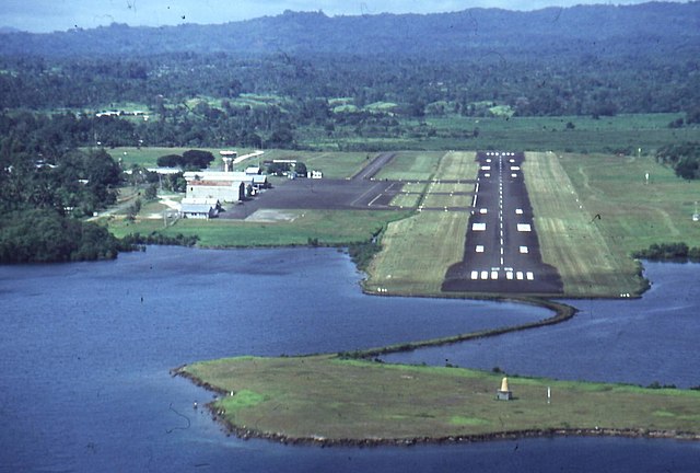
Deutsch: Dies ist der Madanger Flughafen, schön am Hafen zur Südsee gelegen. |
| Dată | circa 1990 |
| Sursă | Privat |
| Autor | K. Winarske |
| Poziția obiectului | | Vizualizați poziția acestei și a altor imagini la: OpenStreetMap |
|---|
.jpg¶ms=-05.208333_N_0145.783333_E_globe:Earth_class:object_region:PG_type:landmark_&language=ro)
Licențiere

|
This work is free software; you can redistribute it and/or modify it under the terms of the GNU General Public License as published by the Free Software Foundation; either version 2 of the License, or any later version. This work is distributed in the hope that it will be useful, but without any warranty; without even the implied warranty of merchantability or fitness for a particular purpose. See version 2 and version 3 of the GNU General Public License for more details. |
Istoricul fișierului
Apăsați pe Data și ora pentru a vedea versiunea trimisă atunci.
| Data și ora | Miniatură | Dimensiuni | Utilizator | Comentariu | |
|---|---|---|---|---|---|
| actuală | 24 mai 2006 21:49 | | 1.530x1.033 (133 KB) | JonathanWinarske | *Bildbeschreibung: Dies ist der Madanger Flughafen, schön am Hafen zur Südsee gelegen. *Quelle: Privat *Fotograf/Zeichner: K. Winarske *Datum: ca. 1990 |
Utilizarea fișierului
Următoarele pagini conțin această imagine:
Utilizarea globală a fișierului
Următoarele alte proiecte wiki folosesc acest fișier:
- Utilizare la als.wikipedia.org
- Utilizare la ar.wikipedia.org
- Utilizare la ceb.wikipedia.org
- Utilizare la de.wikipedia.org
- Utilizare la en.wikipedia.org
- Utilizare la fa.wikipedia.org
- Utilizare la fr.wikipedia.org
- Utilizare la gl.wikipedia.org
- Utilizare la he.wikipedia.org
- Utilizare la ja.wikipedia.org
- Utilizare la ko.wikipedia.org
- Utilizare la lez.wikipedia.org
- Utilizare la lt.wikipedia.org
- Utilizare la pl.wikipedia.org
- Utilizare la ru.wikipedia.org
- Utilizare la uk.wikipedia.org
- Utilizare la www.wikidata.org
- Utilizare la xmf.wikipedia.org
- Utilizare la zh.wikipedia.org
.jpg)