Fișier:Old Stone Inn.jpg

Mărimea acestei previzualizări: 800 × 557 pixeli. Alte rezoluții: 320 × 223 pixeli | 640 × 445 pixeli | 1.024 × 713 pixeli | 1.280 × 891 pixeli | 2.560 × 1.782 pixeli | 4.654 × 3.239 pixeli.
Mărește rezoluția imaginii (4.654 × 3.239 pixeli, mărime fișier: 2,04 MB, tip MIME: image/jpeg)
| Acest fișier se află la Wikimedia Commons. Consultați pagina sa descriptivă acolo. |
|
This is an image of a place or building that is listed on the National Register of Historic Places in the United States of America. Its reference number is 76000944. |
| Poziția aparatului de fotografiat | | Vizualizați poziția acestei și a altor imagini la: OpenStreetMap |
|---|
| Descriere |
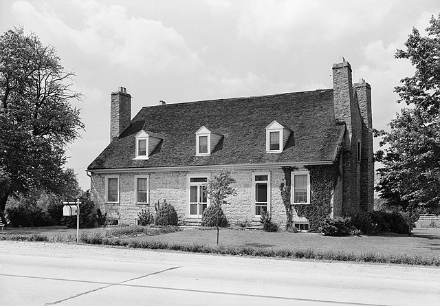
English: Front of the Old Stone Inn, located along U.S. Route 60 east of Simpsonville in Shelby County, Kentucky, United States. Built in 1816, it is listed on the National Register of Historic Places. |
|||||
| Dată | ||||||
| Sursă | Library of Congress, Prints and Photograph Division HABS: KY,106-SHELB.V,2-1 | |||||
| Autor | Lester Jones | |||||
| Permisiune (Reutilizarea acestui fișier) |
|


|
Această image este disponibilă pe pagina Prints and Photographs division a Bibliotecii Congresului Statelor Unite ale Americii, sub numărul de identificare hhh.ky0112.
Acest format nu indică statutul de drept de autor sau sursa lucrării atașate. Un format normal și o sursă sunt de asemenea necesare. Vezi Commons:Licenţiere pentru mai multe informații.
|
Istoricul fișierului
Apăsați pe Data și ora pentru a vedea versiunea trimisă atunci.
| Data și ora | Miniatură | Dimensiuni | Utilizator | Comentariu | |
|---|---|---|---|---|---|
| actuală | 20 ianuarie 2010 18:11 | | 4.654x3.239 (2,04 MB) | Nyttend | {{Location|38|13|21|N|85|20|52|W}} {{Information |Description={{en|Front of the {{w|Old Stone Inn}}, located along {{w|U.S. Route 68}} east of {{w|Simpsonville, Kentucky|Simpsonville}} in {{w|Shelby County, Kentucky|Shelby County}}, {{w|Kentucky}}, {{w|Un |
Utilizarea fișierului
Următoarele pagini conțin această imagine:
Utilizarea globală a fișierului
Următoarele alte proiecte wiki folosesc acest fișier:
- Utilizare la arz.wikipedia.org
- Utilizare la ceb.wikipedia.org
- Utilizare la de.wikipedia.org
- Utilizare la en.wikipedia.org
- Utilizare la www.wikidata.org