Modul:Location map/data/Irak/doc
Aceasta este pagina de documentație pentru Modul:Location map/data/Irak
|
|
Aceasta este pagina de documentație pentru Modul:Location map/data/Irak. Pagina descrie modul de folosire al formatului și conține categoriile de care acesta aparține, precum și orice altceva ce nu face parte din formatul propriu-zis. Ea poate fi editată modificând pagina Modul:Location map/data/Irak/doc |
| nume | Irak | |||
|---|---|---|---|---|
| border coordinates | ||||
| 37.7 | ||||
| 38.4 | ←↕→ | 48.9 | ||
| 28.4 | ||||
| map center | 33°03′N 43°39′E / 33.05°N 43.65°E | |||
| imagine | Iraq location map.svg
| |||

| ||||
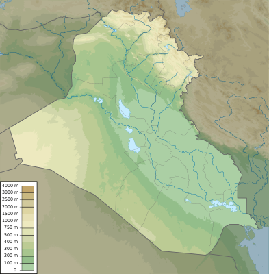
| imagine1 | Iraq physical map.svg
| |||

| ||||

Modul:Location map/data/Irak este o definiție de hartă de localizare folosită pentru suprapunerea de marcaje și etichete pe o hartă cu proiecție cilindrică echidistantă(d) reprezentând [[Irak ]]. Marcajele se pun după coordonatele de latitudine și longitudine pe harta implicită sau pe imaginea unei hărți similare.
Utilizare
Aceste definiții se folosesc în următoarele formate atunci când sunt invocate cu parametrul "Irak":
- {{location map| Irak | ...}}
- {{location map many| Irak | ...}}
- {{location map+| Irak | ...}}
- {{location map~| Irak | ...}}
Definiția hărții
name = Irak
- Numele utilizat în descrierea implicită a hărții
image = [[:File:Iraq location map.svg
|Iraq location map.svg
]]
- Imaginea implicită, fără "Imagine:" sau "Fișier:"
top = 37.7
- Latitude at top edge of map, in decimal degrees
bottom = 28.4
- Latitude at bottom edge of map, in decimal degrees
left = 38.4
- Longitude at left edge of map, in decimal degrees
right = 48.9
- Longitude at right edge of map, in decimal degrees
Precision
Longitude: from West to East this map definition covers 10.5 degrees.
- At an image width of 200 pixels, that is 0.0525 degrees per pixel.
- At an image width of 1000 pixels, that is 0.0105 degrees per pixel.
Latitude: from North to South this map definition covers 9.3 degrees.
- At an image height of 200 pixels, that is 0.0465 degrees per pixel.
- At an image height of 1000 pixels, that is 0.0093 degrees per pixel.
Examples using location map templates
Location map, using default map (image)
Eroare Lua în Modul:Location_map la linia 539: attempt to compare nil with number
{{Location map | Irak
| width   = 250
| lat_deg = 33.33
| lon_deg = 44.42
| label   = Baghdad
}}
Location map many, using relief map (image1)
Eroare Lua în Modul:Location_map la linia 539: attempt to compare nil with number
{{Location map many | Iraq
| relief   = yes
| width    = 250
| caption  = Două locații în Irak
| lat1_deg = 33.33
| lon1_deg = 44.42
| label1   = Baghdad
| lat2_deg = 36.34
| lon2_deg = 43.13
| label2   = Mosul
}}
Location map+, using AlternativeMap
{{Location map+ | Irak
| AlternativeMap = Iraq physical map.svg
| width   = 250
| caption = Two locations in Irak
| places  =
  {{Location map~ | Irak
  | lat_deg = 33.33
  | lon_deg = 44.42
  | label   = Baghdad
  }}
  {{Location map~ | Irak
  | lat_deg = 36.34
  | lon_deg = 43.13
  | label   = Mosul
  }}
}}
See also
- Location map templates
- Template:Location map, to display one mark and label using latitude and longitude
- Template:Location map many, to display up to nine marks and labels
- Template:Location map+, to display an unlimited number of marks and labels
- Infobox templates incorporating (passing values to) the Location map template
- Format:Infocaseta Aeroport — hartă alternativă: relief (via pushpin_relief) și AlternativeMap (via pushpin_image)
- Format:Infocaseta Sit arheologic — hartă alternativă: relief
- Format:Infocaseta Pictură
- Format:Infocaseta Clădire — hartă alternativă: relief
- Format:Infocaseta Cazinou
- Format:Infocaseta Castru — hartă alternativă: relief (via map_relief)
- Format:Infocaseta Peșteră (via Infobox map) — hartă alternativă: relief
- Format:Infocaseta cemetery
- Format:Infocaseta civil conflict
- Format:Infocaseta climbing route (via Infobox map) — alternative map support: relief
- Format:Infocaseta church — alternative map support: relief
- Format:Infocaseta concentration camp
- Format:Infocaseta dam — alternative map support: relief
- Format:Infocaseta dava
- Format:Infocaseta forest (via Infobox map) — alternative map support: relief
- Format:Infocaseta glacier (via Infobox map) — alternative map support: relief (displays relief image unless map_relief=0)
- Format:Infocaseta golf facility — alternative map support: relief
- Format:Infocaseta historic site — alternative map support: relief (via map_relief)
- Format:Infocaseta hospital — alternative map support: relief
- Format:Infocaseta hut — alternative map support: relief
- Format:Infocaseta lighthouse — alternative map support: relief
- Format:Infocaseta map (used by other infoboxes) — alternative map support: relief
- Format:Infocaseta military conflict — alternative map support: relief (via map_relief)
- Format:Infocaseta military installation — alternative map support: relief (via map_relief)
- Format:Infocaseta monastery
- Format:Infocaseta mountain (via Infobox map) — alternative map support: relief (displays relief image unless map_relief=0)
- Format:Infocaseta mountain pass (via Infobox map) — alternative map support: relief (displays relief image unless map_relief=0)
- Format:Infocaseta mountain range (via Infobox map) — alternative map support: relief (displays relief image unless map_relief=0)
- Format:Infocaseta museum — alternative map support: relief (via map_relief)
- Format:Infocaseta oil field — alternative map support: relief
- Format:Infocaseta oil refinery — alternative map support: relief
- Format:Infocaseta operational plan
- Format:Infocaseta park (via Infobox map) — alternative map support: relief
- Format:Infocaseta power station — alternative map support: relief
- Format:Infocaseta protected area (via Infobox map) — alternative map support: relief
- Format:Infocaseta reactor
- Format:Infocaseta religious building — alternative map support: relief
- Format:Infocaseta restaurant
- Format:Infocaseta settlement — alternative map support: relief (via pushpin_relief) and AlternativeMap (via pushpin_image)
- Format:Infocaseta spring (via Infobox map) — alternative map support: relief
- Format:Infocaseta temple
- Format:Infocaseta terrestrial impact site
- Format:Infocaseta valley (via Infobox map) — alternative map support: relief
- Format:Infocaseta waterfall (via Infobox map) — alternative map support: relief
- Format:Infocaseta World Heritage Site — alternative map support: relief